How Do School Catchment Changes Affect Neighbourhoods? (England & Wales)
How school catchment changes in England and Wales shift demand and daily life on nearby streets, and which official checks to run before you move.
Catchment changes redraw the zone a school gives admissions priority to, so streets that move in or out of a boundary can see shifting buyer demand, altered school runs and changed daily routines. The effect is strongest at the boundary and in the first year it applies, fades with distance, and depends on how oversubscribed the school is. In England and Wales, councils and admissions authorities set and publish these boundaries.
In this post
- Table of Contents
- What a School Catchment Area Is and Who Sets It
- How to Find a School Catchment Area Map for Any Address
- Why School Catchment Changes Happen
- What Catchment Changes Can Do to a Neighbourhood
- How to Check School Admissions Catchment Area Rules for a Specific Property
- Using School Planning Applications to See What Is Coming
- Deciding Your Next Step Before You Make an Offer
- Frequently Asked Questions
Last Updated: 7 November 2026
Quick Summary
School catchment changes alter the zone from which a school gives priority to applicants, so they can shift demand and daily routines in nearby streets. The effect is usually strongest on streets that move in or out of the new boundary and fades with distance.
- Check the current admissions round, since a catchment map covers one year only.
- Catchment is one oversubscription criterion, and siblings can rank above it.
- Planning applications for large housing schemes can signal a future boundary review.
- Confirm a split street or new-build address with the council in writing.
Table of Contents
- What a School Catchment Area Is and Who Sets It
- How to Find a School Catchment Area Map for Any Address
- Why School Catchment Changes Happen
- What Catchment Changes Can Do to a Neighbourhood
- How to Check School Admissions Catchment Area Rules for a Specific Property
- Using School Planning Applications to See What Is Coming
- Deciding Your Next Step Before You Make an Offer
- Frequently Asked Questions
What a School Catchment Area Is and Who Sets It
A school catchment area is the geographic zone from which a school gives priority to applicants, and understanding how school catchment changes affect that zone is the first step in planning a move. If a home sits inside the zone, the child has a stronger claim to a place at that school than a child living outside it. Local authorities usually set catchment areas for community schools, while academies and faith schools often publish their own admissions criteria.
Catchment is not the same as a guarantee. Many schools in England and Wales are oversubscribed, so a catchment boundary can decide the outcome even when a family lives close by. Boundaries are drawn to reflect where children live, but they can be adjusted, and the rules for each school are set out in its published admissions policy.
How to Find a School Catchment Area Map for Any Address
Follow these steps to find the catchment information for a specific home:
- Check the local council's website for its admissions or school places pages.
- Search for the school's catchment map or "catchment area" document, usually published as a PDF or interactive map.
- Enter the full postcode or address into the council's school search tool, where one is provided.
- Read the school's admissions policy for the year you need, since criteria can differ from one year to the next.
- Confirm the boundary with the school office if the map is unclear near a road or a split street.
Watch out: a map shows the boundary for one year only. Always check the current admissions round before you rely on it.
Why School Catchment Changes Happen
Catchment boundaries are reviewed when local conditions shift. The two most common drivers are population change and the number of places a school can offer.
Population growth and new housing
When new homes are built, more children need a place nearby. Councils often respond by reviewing where boundaries fall, and large housing developments can prompt changes to the catchments of several schools at once. Planning applications are a useful early signal of where this growth is heading.
Changes to school capacity and admissions rules
A school that expands, or one that reduces its intake, can move its boundary. Changes to admissions rules, such as how siblings or distance are prioritised, can also alter which addresses are in a catchment without any change to the map itself.
What Catchment Changes Can Do to a Neighbourhood
A catchment change is rarely felt evenly across a neighbourhood. The effects tend to concentrate on the streets closest to the new boundary, on roads that sit either side of a split, and on newer estates where families with young children have moved in. Understanding the mechanism helps you read what is actually happening rather than what is being repeated in local Facebook groups.
The demand effect on nearby streets
When a popular school's catchment is redrawn, homes that fall inside the new boundary can attract more interest from families, while homes just outside may see a different mix of buyers. A common pattern is that the effect is strongest on the streets that change status, in or out, and fades with distance. It also depends on how oversubscribed the school is.
This is where official data helps. Sold-price records from HM Land Registry show what actually changed hands, and asking prices on the portals show what sellers are hoping for. Neither tells you what a property is worth, and neither is a valuation, they are evidence to weigh alongside everything else.
The daily-routine effect
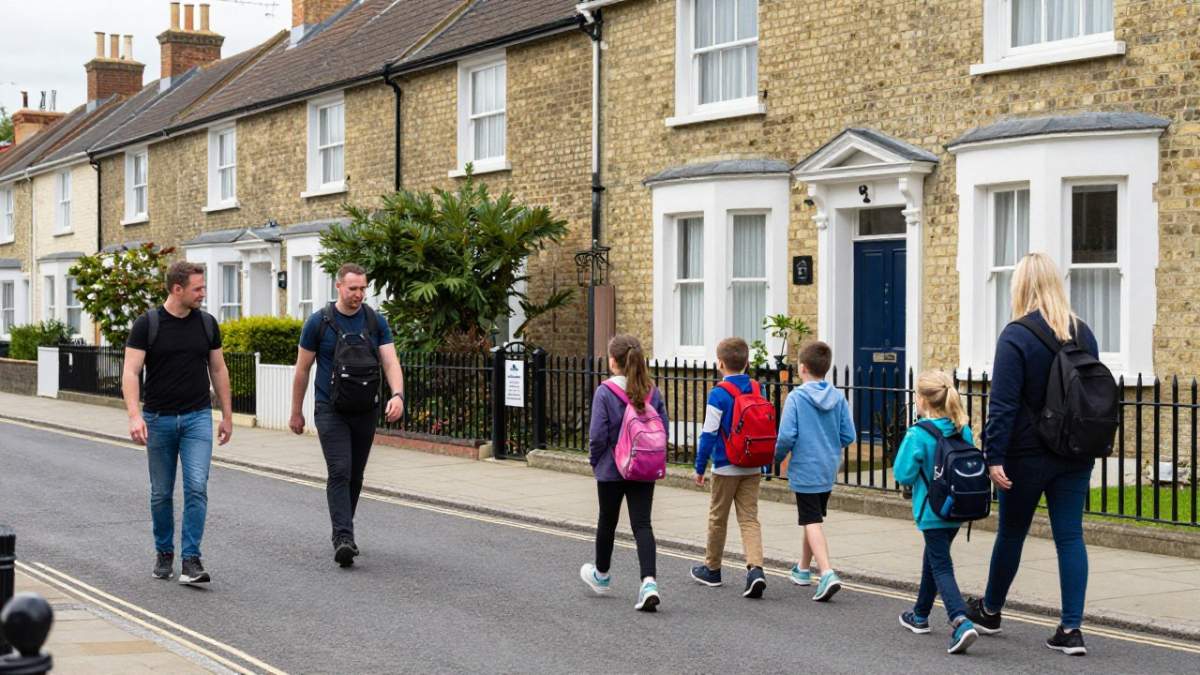
A boundary change can move children from one school to another, which alters walking routes, the school run, crossing points and where friendships form. In practice the biggest disruption is often at the transition, the year the new boundary first applies, rather than permanently. Parents who bought specifically for a school should check the admissions policy for the year their child will actually start, not the year they bought.
The planning signal
New housing is the most common trigger for a boundary review, and the planning register is the earliest public signal. A large scheme near an existing school may lead to a review later on, and a review may lead to a change. Treat an application as a reason to ask questions, not a settled outcome: many schemes are amended, reduced or never built. Our guide to how to find planning applications near a property in England & Wales walks through the register.
What the data can and cannot tell you
You can check recorded crime against the national average on police.uk, flood risk from the Environment Agency, noise and nuisance sites, and sold prices from HM Land Registry. What no dataset tells you is whether a school place will be offered, or what a home is worth. Catchment is one factor among many, and the honest position is that the effect varies from one area to another.
How to Check School Admissions Catchment Area Rules for a Specific Property
The useful part is the sequence: how a boundary is set, published, applied and sometimes corrected, and what to do when the answer is unclear. The steps below follow that sequence.
Step 1: identify the schools that serve the address
Start with the local authority's admissions pages, not a third-party map. Councils publish catchment maps and school search tools by postcode. Where a council does not provide a search tool, the school's own website usually publishes its catchment document as a PDF or interactive map. Note the admissions year the document covers, a map is published for one round only.
Step 2: read the oversubscription criteria in order
A catchment is usually one criterion among several. The order matters: a school may prioritise looked-after children, then siblings, then catchment, then distance. A home inside the catchment can still lose out to a sibling living outside it. Read the criteria in the order they are listed, and check whether the school uses straight-line distance or a measured walking route, because the two can produce different results on the same street.
Step 3: check the school's recent offer history
Councils sometimes publish how places were allocated in recent years, for example the furthest distance offered under each criterion, where this information is available. A school that has offered to addresses well beyond its catchment is unlikely to be constrained by the boundary; one that has filled within a short radius is more likely to be.
Step 4: confirm the address against the official map
Check the full postcode, not just the street. Split streets, new-build plots and converted buildings are where errors cluster. If the map is unclear at a boundary, ask the school office or the local authority's admissions team to confirm in writing how the criteria apply to that address. A written confirmation is worth more than a screenshot of a map.
Step 5: know what to do if the record looks wrong
If a catchment map appears out of date, or an address is missing from a school's published list, the route is the local authority's admissions team first and the school's admissions authority second. Keep the date of the document you relied on.
Watch out: a map that is a year or two old can still be live on a council website, and a boundary shown there may already have been superseded for the current admissions round.
Scotland and Northern Ireland run separate school admissions systems, so the council-by-council approach described here applies to England and Wales.
The steps below follow how a catchment boundary is set, published, applied and sometimes corrected, so a reader can see where to check each part.
| Step | What to do | Key point |
|---|---|---|
| 1. Identify schools | Use council admissions pages, not third-party maps | Note the admissions year the map covers |
| 2. Read criteria | Check the order of oversubscription criteria | Catchment can rank below siblings |
| 3. Check offer history | Look at recent allocation distances, where published | Shows whether the boundary really constrains places |
| 4. Confirm address | Check the full postcode against the official map | Split streets and new builds are error-prone |
| 5. Resolve errors | Contact the council admissions team first | Keep the date of the document you relied on |
Using School Planning Applications to See What Is Coming
Planning applications can show future pressure on local schools. A large housing scheme near an existing school may lead to a boundary review later on. To look up applications near a property, search the council's online planning register, filter by address or postcode, and read the dates and drawings. You can find more detail in our guide to how to find planning applications near a property in England & Wales.
Planning applications are a signal, not a confirmed change. Many schemes are amended or never built, so treat them as a reason to ask questions rather than a settled outcome.
Deciding Your Next Step Before You Make an Offer
Before you make an offer, confirm the current catchment boundary and the school's admissions rules directly with the council. Keep in mind that changes can happen after you buy. A separate look at school quality can help too: our explainer on what the new Ofsted grades mean covers how to read a report. You may also want to verify the exact boundary by following our step-by-step guide on how to verify local school catchment area boundaries.
Jackson's area reports bring together official data on planning, crime, flood risk and noise for a postcode, so you can see the wider picture alongside school information. Person-checked reports (from £19) are read and signed by a named analyst and delivered as a PDF; the £9 Instant Report is checked by a review agent, not read by a person. An area report sits alongside a survey and a conveyancer's checks; it does not replace them.
Frequently Asked Questions
How do I find out if my school catchment area has changed?
Start with the local authority that runs the school admissions service for the area. Most councils publish current catchment maps and admissions criteria on their websites, usually with a publication date or academic year. Compare the map for the year you are interested in against the previous one, and check whether the school's published admissions arrangements have been updated. If a boundary change is proposed, it will normally appear in a public consultation before it takes effect. Keep a dated copy of the map you rely on, because boundaries and rules can change between admissions rounds.
How often do school catchment areas change?
There is no fixed schedule. Catchment boundaries are reviewed when admissions rules change, when a new school opens or an existing one expands, or when significant housing development alters the number of children in an area. Many local authorities review their arrangements annually as part of the statutory admissions process, but the boundaries themselves do not always change each year. The safest approach is to check the current year's published arrangements rather than relying on a map from a previous search.
Do catchment boundaries guarantee a place at a school?
No. Living inside a catchment area is not a guarantee of a place. Admissions depend on the school's published oversubscription criteria, which often include factors such as siblings already at the school, distance and other priorities set out by the admissions authority. Where a school is oversubscribed, the order of priority matters more than the boundary line alone. Read the full admissions policy for the school you are considering, and treat the catchment map as one input rather than a promise.
How can I check the history of local planning applications for a school?
Use the planning portal of the local planning authority, which lists applications by address or postcode and shows the decision and date. Search for the school name or its address, and look for extensions, new classrooms, or new housing nearby that may increase pupil numbers. Planning history shows what has been proposed or approved, but not whether it will be built or when. For the boundary effect itself, check the local authority's admissions consultation documents, which set out the reasons for any change.

Short on time? Let us run the checks for you
Viewing this weekend and don't fancy an afternoon of maps? The free Foolproof Viewing Check pulls the headline tiles for any address you're looking at — no card, no sign-up.
Want the whole area read by hand and written up, checked and signed off by a real person before it reaches you? That's the Jackson pre-purchase area report. Software does the legwork so it's quick and affordable; a person makes the call so you can trust it. Reports start from £19.
Frequently asked questions
How do I find out if my school catchment area has changed?
Start with the local authority that runs the school admissions service for the area. Most councils publish current catchment maps and admissions criteria on their websites, usually with a publication date or academic year. Compare the map for the year you are interested in against the previous one, and check whether the school's published admissions arrangements have been updated. If a boundary change is proposed, it will normally appear in a public consultation before it takes effect. Keep a dated copy of the map you rely on, because boundaries and rules can change between admissions rounds.
How often do school catchment areas change?
There is no fixed schedule. Catchment boundaries are reviewed when admissions rules change, when a new school opens or an existing one expands, or when significant housing development alters the number of children in an area. Many local authorities review their arrangements annually as part of the statutory admissions process, but the boundaries themselves do not always change each year. The safest approach is to check the current year's published arrangements rather than relying on a map from a previous search.
Do catchment boundaries guarantee a place at a school?
No. Living inside a catchment area is not a guarantee of a place. Admissions depend on the school's published oversubscription criteria, which often include factors such as siblings already at the school, distance and other priorities set out by the admissions authority. Where a school is oversubscribed, the order of priority matters more than the boundary line alone. Read the full admissions policy for the school you are considering, and treat the catchment map as one input rather than a promise.
How can I check the history of local planning applications for a school?
Use the planning portal of the local planning authority, which lists applications by address or postcode and shows the decision and date. Search for the school name or its address, and look for extensions, new classrooms, or new housing nearby that may increase pupil numbers. Planning history shows what has been proposed or approved, but not whether it will be built or when. For the boundary effect itself, check the local authority's admissions consultation documents, which set out the reasons for any change.